Labels

A B C D E F H J L M O P R T

Friday, August 5, 2011

RV Celtic Explorer VENTuRE Survey - Arrival in Cork

On arrival in Cork the mission team met was greeted by Minister for Agriculture, Food and Marine Mr. Stephen Coveney T.D., Marine Institute Dr. Peter Heffernan and a number of senior staff from University College Cork including Professor Patrick Fitzpatrick Head of the College of Science, Engineering and Food Science. The success of the project also attracted a great deal of interest from the media and a press conference featuring mission leader Dr. Andy Wheeler and Dr. Bram Murton.

What follows are a number of pictures taken on the day at a very successful end to an extremely successful mission.

Congratulations to everyone involved.
Caption:  Minister for Agriculture, Food and Marine Mr. Simon Coveney TD flanked by Dr. Andy Wheeler (left) and Dr. Bram Murton and Prof. Patrick Fitzpatrick (right) plus the VENTuRE scientific team, the ship’s Captain Denis Rowan and Dr. Peter Heffernan, CEO of the Marine Institute (far left) (Photo: Provision).

Dr. Peter Heffenan (CEO, Marine Institute), Maria Judge (Geological Survey of Ireland) and Minister Coveney on the bridge of the RV Celtic Explorer (Photo: Provision)


Mission Leader Dr. Andrew Wheeler explains how the hydrothermal vents were found at the post-mission press conference (Photo: Provision)


Caption: A "blind" shrimp from the hydrothermal vent field (Photo: Patrick Collins NUI Galway)


Caption : Snails from the outside of the hydrothermal vents. (Photo: Patrick Collins: NUI Galway)

Thursday, August 4, 2011

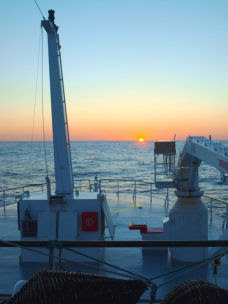
RV Celtic Explorer Venture Survey: Day 5 +

The VENTuRE Cruise: Discoveries from the Deep

On arriving at the target site there was growing excitement on board the RV Celtic Explorer for the scientists and crew.  More than a year before, signs of hydrothermal vents had been detected by UK scientists – tiny signals of cloudiness in the water at depth indicating the presence of vents producing sulphide rich black smoke.  Now the job of the combined Irish and UK team was to try and locate this small target up to 3000m below the RV Celtic Explorer.  More than two days away from the Azores the site was about as far from land in any direction as is possible in the vast expanse of the Atlantic.

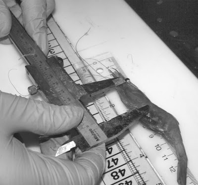
Luckily the weather was now on our side, as we began to hunt for the plumes of smoky water expelled from hydrothermal vents. For this we used sensors on a CTD rig designed to measure depth, temperature, cloudiness of the water and Eh (which indicates the presence of sulphide rich water). Work began at half an hour after midnight on the 21st of July and went on day and night for the next three days.  The CTD was let out to more than 2000 metres depth and regularly raised and lowered through the water column while being towed at a quarter of a knot (a procedure called Tow-Yo CTDing).  In that time two ROV dives down to the bottom to check out promising signals revealed nothing. 

By day three we had many plume signals but still no positive sighting of the vents themselves – this was truly becoming a frustrating search for a needle in a haystack. Normally, searching new hydrothermal vents takes several weeks, sometimes years, but we had only a few days.  Finally, a strong Eh signal was followed closely by strong temperature signal, indicating a 'hot spot' close to the vent site. The fluid emitted directly from the vents is hot, roughly 350cC, instantly diffusing to 5cC a few meters from the vent as it mixes with cold seawater. The background temperature in the deep sea is about 3cC. After spending forty hours searching, we had plume signals boxed in, in record time! But the site appeared to be close to a 200m high cliff. The search would require skilled and careful ROV work.

The ROV Holland I was deployed with a full suite of cameras recording continuously in four directions. Tense with excitement, the team followed the progress of the ROV over lava flows covering the sea floor to the edge of the cliff at 2800 metres – and over and down.  The day watch team on the 24th of July first spotted traces of smoke in the water at 2900 metres. Powerful lights and lasers on the ROV caught glittering sulphide particles and black soot in the water column.  Soon billowing clouds of black smoke engulfed the ROV. The vent was close!  News traveled throughout the ship like wildfire and the science lab was filled with scientists and crew.  The ROV crept deeper and deeper 2950, 2980, 2990 metres.  Suddenly, just before midnight, after more tense navigation through swirling black smoky water, crusty columnar chimneys belching black smoke emerged into view.  A new vent site had been found! All hell broke loose in the science lab……
  

First time ever seen by human eyes, the Moytirra vent field. Picture shows chimneys of metal sulphides (black and rust coloured) at 3030m below sea level formed. They are precipitated from hot fluid erupting from the volcanic mid-Atlantic Ridge. The white mineral is anhydrite.
Another view of the main chimney in the Moytirra vent field. This time the mid-section. This chimney by global standards is huge with an impressive girth and stands over 10m tall. Laser dots are 10cm apart.


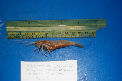
Another view from the Moytirra vent field. "Black smoke" (volcanically heated hot vent fluid issuing from the seabed with high concentrations of metal sulphides) can be see leaking from half way up the chimney. Shrimp make a home on the vent. 

 The summit of the chimney with a large concentrated plume of metal sulphide enrich vent fluid issuing from the top.

 
A cooler less active (but still venting) chimney complex with less life.

For more on the VENTuRE cruise, please check out the Science blog spot:

http://scientistsatsea.blogspot.com

and UCC's student website: http://blogs.ucc.ie/wordpress/bees

And the GSI blog: http://www.infomar.ie/blog/index.php

Tuesday, July 19, 2011

RV Celtic Explorer Venture Survey: Day 4


Date: 19/07/2011
Time: 0430h (UTC)
Position: 48 deg 12.30' N 22 deg 00.36' W
Wind speed: 20 knots

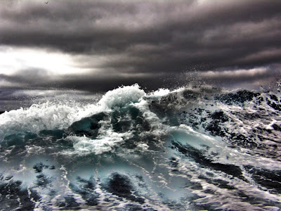
We ran into rough weather on Sunday night, with the wind gusting at more than 40 knots and NOAA (the US National Oceanic and Atmospheric Administration) reporting average seven-metre swells in our area.  Those conditions forced us to pause our passage and turn the ship into the weather for several hours.  But although conditions were challenging for those aboard, our tying down of equipment proved secure, and we were able to resume course for the Mid-Atlantic Ridge once the seas abated.


Since then we have made steady progress in calmer seas, and expect to arrive over the Mid-Atlantic Ridge on Wednesday afternoon.  Once the seas had calmed, we also held a routine emergency drill.  Everyone reported to their “muster point” in response to the ship’s alarm system, and practised donning lifejackets and immersion suits.


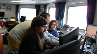
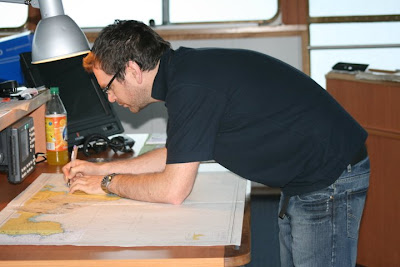
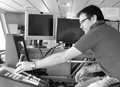
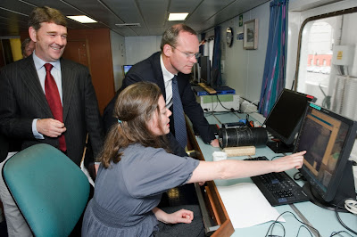
As we get closer to the Mid-Atlantic Ridge, we’ve also been fine-tuning our procedures for collecting data and samples once we arrive.  This has involved meetings and discussions with members of the team who operate the ROV, and among members of the science team who will be sharing samples.  These preparations have created an air of quiet expectation in the labs aboard the ship, as the Mid-Atlantic Ridge draws nearer.

Follow our “student eye on live during the survey” at http://blogs.ucc.ie/wordpress/bees/

Sunday, July 17, 2011

RV Celtic Explorer VENTure Survey: Day 2

Date: 16/07/2011
Time: 1830h (UTC)
Position: 52 deg 13.16' N 12 deg 14.88' W
Wind speed: 30 knots


We left the Galway area in the small hours of the morning and headed out into the North Atlantic, where we met lively seas. The swell has been around four metres today, and many of our expedition team have been acclimatising to the motion. But despite the pitching of the ship, Jimmy and Lou in the galley have still conjured up tasty meals for everyone.


After lunch, Bramley Murton from Southampton gave a talk about the geology of our destination: the mid-ocean ridge. The mid-ocean ridge is a 65000 km chain of undersea volcanoes that runs around the globe like the seam on a tennis ball. The volcanoes form where the huge plates of the Earth's crust are moving apart, which happens in the Atlantic at about the same rate that our fingernails grow. The lava erupting from the volcanoes of the mid-ocean ridge creates new crust to fill the gap between the parting plates.


What happens at the mid-ocean ridge shapes our world, but all the details of the geological processes occurring there are still not clear. Seventy years ago, no-one even knew the extent of the mid-ocean ridge, despite it being our planet's longest geological feature. It was only when scientists started comparing echosounder traces from ships crossing the oceans that they realised there was a vast mountain range beneath the waves. Today our journey is taking us there, to the edge of creation of the Earth's crust, to find out more.

Saturday, July 16, 2011

RV Celtic Explorer VENTure Survey: Day 1

Date: 15/07/2011
Time: 2000h (UTC)
Position: 53 deg 09.67' N 09 deg 36.53' W
Wind speed: 16 knots

We have spent today completing our final preparations, before we head offshore from Galway.  Once we're out in the North Atlantic, we will be on our own: no service engineer is going to visit us if we have a problem with any equipment, so we've been making sure that everything is in working order, and that we have any spares that we might need.

With a voyage of exploration such as ours, we need to know exactly where we are before we can map places where no-one has been before.  So our checklist has included calibrating the underwater navigation system for our deep-diving remotely-operated vehicle (ROV), the Holland-1.  Like any modern vessel, the RV Celtic Explorer uses pinpoint-precision satellite navigation.  But those GPS signals do not reach the deep ocean, so we use an additional sonar beacon system to track the ROV relative to the ship during its dives.


The remotely operated vehicle ROV Holland 1


In the evening, we launched the ROV on a test dive.  One of the tasks for this dive was to test and calibrate the multibeam sonar system, which can map the seafloor in fine detail.  We're very grateful to the Geological Survey of Ireland for providing us with vital data, through the INFOMAR Programme, to complete that calibration test and prepare for the voyage ahead.

Our journey to the Mid-Atlantic Ridge will take around three-and-a-half days.  Although the weather over our target area looks good at the moment, we're expecting some rough seas on the way there.  So another important task has been tying down all our equipment securely--from the computers in the "dry lab" to the microscopes in the "wet lab"--ready for any rocking and rolling.

Once our final checks are complete, we'll be leaving the Galway area overnight, bound for the undersea volcanoes of the Mid-Atlantic Ridge.

Thursday, July 14, 2011

Life in 'Inner Space' - Joint Mission to Film Deep Ocean Vents Sets Sail


The mission, led by Dr. Andy Wheeler of University College, Cork (UCC), will be investigating life at 3,000 metres below the surface of the sea on the ‘45o North MAR hydrothermal vent field’ using the Remotely Operated Vehicle (ROV) Holland 1. These vents, which spew mineral rich seawater heated to boiling point by volcanic material in the earth’s crust below, are home to a rich variety of marine life that thrives in complete darkness on bacteria fed by chemicals.

Patrick Collins from NUI Galway’s Ryan Institute will lead Ireland's marine biological team investigating this unique ecosystem, which could tell us not only about how life might have evolved on other planets, but may also be a rich source of new biochemical processes with valuable medical and industrial applications.

“This expedition offers us the first opportunity to investigate mineral deposits and vent animals in this unexplored and important part of the Mid-Atlantic Ridge,” said Dr. Bramley Murton of the UK's National Oceanography Centre at Southampton (NOC), who first discovered the location of the vents on an expedition aboard the UK research vessel RRS James Cook in 2008, and who is now leading the mineralisation study on the expedition. “Nothing is known about the hydrothermal vents, their mineral deposits or the life they support on the Mid-Atlantic Ridge between the islands of the Azores to the south and Iceland to the north. Because this part of the ridge is trapped between these islands, vent animals may have evolved in isolation and be quite unique from elsewhere.”


The ROV Holland 1

Patrick Collins, in collaboration with Jon Copley of the NOC, will catalogue and characterise the species found at the vents.  According to Patrick, “We hope to find a whole community of previously unknown species, increasing our understanding of deep sea biogeography. There is potential here to put Ireland on the global map as a serious player in deep sea science. This is all the more timely with the exploitation of deep sea and hydrothermal vents for precious metals and rare earth minerals now a reality.”

Another objective of the mission is to investigate the rich deposits of deepwater corals on the Porcupine Bank’s ‘Moira Mound’, which has already been designated as a Special Area of Conservation.  These corals, which are very delicate and grow extremely slowly, are highly susceptible to damage by deepwater trawling and mineral dredging operations. Dr. Andy Wheeler, Chief Scientist of the Expedition, is a veteran of four previous ROV surveys to coldwater coral mounds.


Dr Andy Wheeler and Dr Peter Heffernan of the Marine Institute
at the RV Celtic Explorer in Galway docks yesterday

This mission is supported by the Marine Institute under the 2011 Ship-Time Programme of the National Development Plan. “This project is a perfect example of how strategic funding can pump-prime world-class marine research led from Ireland into new and exciting areas with tremendous potential for future sustainable development,” said Dr. Peter Heffernan, Chief Executive of the Marine Institute. The research is also supported by the National Geographic Society.

The mission carries geochemists, marine biologists, marine geologists, marine geneticists and technicians from Ireland and the UK as well as a three-person TV crew from National Geographic. They will spend 25 days at sea and will be posting a regular blog here on Blogger.

Undiscovered ‘alien’ life forms that thrive without sunlight in temperatures approaching boiling point may soon come to light thanks to a groundbreaking Irish-led marine research mission aboard the national research vessel RV Celtic Explorer which set sail from Galway, Ireland yesterday (Wednesday 13th July).  The voyage is being filmed for the National Geographic Channel for inclusion in an upcoming series about the ocean.


The mission team alongside the RV Celtic Explorer in Galway Docks

Thursday, March 3, 2011

RV Celtic Explorer Newfoundland & Labrador Fishery Survey: DAY 32

Date 2/03/2011 Time: 23:00 hrs (UTC)

Position:   47 57.84N   50 22.89 W   Wind speed 10 knots


Our last day (#32). It was a busy one with lots of research fishing sets in the morning followed by a big clean up in the afternoon.  The weather was much kinder to us today and allowed us to continue to collect valuable data.  During our sets, a sample of shrimp was measured using callipers to measure their carapace length.

Measuring Shrimp – Carapace length using callipers (Photo: Kate Barley)


After a scientific fisheries survey, there is a lot of cleaning up to do …

Graduate students Kyle Krumsick and Genevieve D’Avignon doing the final clean up of the Wet Lab
(Photo: Kate Barley)


Sea Technician Ed Stern making the wet lab shine!  (Photo: Kate Barley)


Deckhand Alec Carty working on lines in preparation for docking tomorrow (Photo: Kate Barley)

Heading westward towards St. John’s – who could not resist putting in the last sunset of our trip
(Photo: Kate Barley)

The sunset was once again wonderful today and I could not help putting in our very last one.  Blogging was new to me at the start of the trip and now I will miss it!  It has been an entertaining way to keep people at home informed and for everyone who has followed us along the way and enjoyed looking at my photographs as much as I enjoy taking them, thank you!  (And if anyone is interested, all photographs taking on this trip will be available to view online through my online gallery, a link can be sent on request).   

And so the survey ends. We wish to thank the Irish Marine Institute for providing us not only with a fine vessel, but with the best of sea mates and crew. Captain Antony Hobin, First Officer Kenny Downing, Officer of the Watch Richard O’Regan, oceanographers Aodhan Fitzgerald and Sheena Fennell and all of the crew were in every respect professional and first rate. It is a trip that we all will remember, in particular the graduate students who for some this was their first time at sea. They may particularly miss the home cooking of Pat and Mickey.

Farewell from all of us …

Blog by Kate Barley with ending by Chief Scientist Dr. George Rose

Tuesday, March 1, 2011

RV Celtic Explorer Newfoundland & Labrador Fishery Survey: DAY 31

Date 1/03/2011 Time: 23:00 hrs (UTC)

Position:   48 01.79 N   47 24.16 W  

Wind speed 40 knots SW, seas 5-6 m

After almost a day of calmer seas – the most we have this trip – we are back in moderate sea states with SW winds ripping across the Grand Banks. We are now near the infamous Flemish Cap, or Bonnet Flamande, as it may have been named by early French fishermen. How the name came about is still in doubt, but the form of this most eastward extension of the Grand Banks does resemble a cap or bonnet.

The Bonnet is also the furthest eastward extension of the continental shelf of North America, and millions of years ago before the opening of the North Atlantic was joined to Spain and North Africa. Ancient fossils found on the eastern shores of Newfoundland are the same as those in Morocco! But it was the rocks of western Newfoundland that inspired Newfoundland geologist Hank Williams to provide unequivocal evidence of the theory of plate tectonics and continental drift in the North Atlantic. And still the drift goes on. Newfoundland and the Grand Banks, with the Flemish Cap its trailing edge, moving doggedly westward at a speed of about 1 cm per year.

The Flemish Cap became infamous in the movie ‘The Perfect Storm’, as supposedly Captain Linda Greenlaw on the vessel Hannah Boden screamed to Billy on the doomed vessel Andrea Gail - ‘The Flemish Cap’, then ‘Billy, you are going into Hell’.

The Great Big Seas (in the singular also a Newfoundland music group) off the Flemish Cap (Photo: Laura Wheeland)

Everything is beautiful, in its own way, goes the song…

Crabs are often used as models for alien creatures in horror or adventure films – made much larger of course. And surely if crabs were very large they would be formidable and frightening creatures. Fortunately for us they are not. Around the fishing world, crab is considered a delicacy and the North Atlantic and Newfoundland and Labrador are no exception. The Snow Crab is by far the most important crab species here. Male Snow Crabs are much larger than females and go through several moults of their shell during their lifetime. Only males are taken in the commercial fishery (thought to be a natural form of conservation). Since the decline of Atlantic cod, Snow Crab has been the mainstay of the Newfoundland and Labrador fishery.


The face only another Snow Crab (Chionocetes opilio) could love (also known as Queen Crab). (Photo: Kate Barley)

Tonight will be last night of the survey. Tomorrow we head for St. John’s and a quick demobilization before the Celtic Explorer refuels and heads back across the Grand Banks and to Cork, Ireland, where the trip began in January.

We will try to post a final blog tomorrow evening.

Blog by Kate Barley and George Rose.


Monday, February 28, 2011

RV Celtic Explorer Newfoundland & Labrador Fishery Survey: DAY 30

Date 28/02/2011 Time: 23:00 hrs (UTC)

Position:   49 30.36 N   50 13.14 W   Wind speed 8 knots


The survey continued today under the best sea conditions we have experienced since leaving Cork, Ireland. A treat for sure, but a brief one, as 45 knot southerlies are expected tomorrow. With luck these southerlies will not last too long and the seas will be moderate. In the dry lab, graduate students were able to concentrate more on the acoustic signals and less on remaining upright.


Graduate students Kyle Krumsick (funny hat), Craig Knickle and Genevieve D’Avignon (looking overly serious) monitoring the acoustic displays in the Dry Lab (Photo: Wade Hiscock)


On the bridge, the crew plotted several new transects to the North Cape of the Grand Bank …

Officer of Watch Richard O’Regan working on the charts on the Bridge


Keeping all the electronic gear on the Celtic Explorer running is no mean feat. Where would we be without the technical help needed to keep it all functioning?


Where would we be without this guy? Electronics tech Lukasz Pawlikowski (Newfoundland spelling – hope its right) on one of his rare moments away from fixing gear.

Another day ends with a tranquil sea for once, heading E on the North Cape of the Grand Bank … Once the most famous fishing ground in the world.

The Celtic Explorer view from the Bridge with the sun setting over the Grand Bank (photo: Kate Barley)

Until tomorrow …


Blog by Kate Barley and George Rose


Celtic Explorer Newfoundland & Labrador Fishery Survey: DAY 29

Date 27/02/2011 Time: 23:00 hrs (UTC)

Position:   49 02.89 N   53 01.43 W   Wind speed 19 knots

Sunrise over Bonavista (Photo: Wade Hiscosk)

We spent most of today in the sheltered waters of Clode Sound, Bonavista Bay, adjacent to Terra Nova National Park, which has both marine and terrestrial components. The Sound was full of herring and capelin, and as a 60 knot storm was raging outside the Bay, we spent the time doing a stationary acoustic experiment, using the Dynamic Positioning system of the Celtic Explorer to hold us in place. The vessel moved within a 50m circle over a period of almost 24h; not bad considering she is 65m in length.

The herring were scattered throughout the water column during hours of darkness, but at the first hint of light they descended quickly to form dense schools near bottom. It will be interesting to test the effects of these movements on the acoustic properties of these fish and how that may influence abundance estimates.

Officer of Watch Richard O’Regan after setting the Dynamic Positioning controls on the Bridge of the Celtic Explorer over dense schools of herring (photo: Kate Barley)

We are close to land here, and most of it is within the Terra Nova National Park. This area was a largely uninhabited region of coastal Newfoundland away from the main cod fishing grounds, and contains a high concentration of Moose and Black Bears. The Woodland Caribou is the native large ungulate of Newfoundland, and figures large in many of the cultural aspects of Newfoundland history and culture. Woodland caribou numbers have declined recently from perhaps 80,000 to 30,000 animals, largely as a result of predation from invading coyotes and black bears.

Newfoundland postage in the 1930s before Confederation with Canada (Newfoundland did not join Canada until 1949). The caribou was and remains the iconic large ungulate of Newfoundland. Note that another stamp featured, of course, the codfish. (public domain image)

The Moose is much larger than the caribou and was introduced to Newfoundland about 100 years ago, and only a few were brought over from the mainland, but from those few animals today their progeny number over 100,000. They are hunted for food and sport by Newfoundland residents and in addition support an important tourism industry.

The Newfoundland bull Moose (Alces alces)
looking regal in autumn (public domain photo)

The crew seemed a bit nervous about the bears when told they are good swimmers – we did not mention that they hibernate in winter and are now fast asleep.

A Black Bear (|Ursus americanus). They are generally not dangerous unless fed by humans (no worries at the moment although Pat’s chicken curry might tempt them) (public domain photo)

But back to the fisheries. Some concentrations of capelin were found deep in the bay. Capelin are a small pelagic fish which feed most everything in the NW Atlantic. Seabirds, whales, seals and most large fishes depend on capelin as a rich source of nutrition. Capelin are rich in fat and protein and smell a bit like cucumbers. The migration patterns of cod have evolved largely to intercept capelin. Capelin are easily the most important fish in these marine ecosystems.

Capelin (photo: Laura Wheeland)

By mid afternoon we were on our way back to the main cod grounds offshore, as the weather forecast bodes well for the next few days.

As we left historic Bonavista Bay, we were treated with a glorious sunset. A welcome change to the previous night spent running with the wind from the approaching storm. This picture was taken standing out on deck with freezing fingers in -6 degrees.

The Celtic Explorer glows in the sunset over Bonavista Bay (photo: Kate Barley)


Until next time…

Blog by Kate Barley with local colour by Dr. George Rose.

Sunday, February 27, 2011

RV Celtic Explorer Newfoundland & Labrador Fishery Survey: DAY 28

Date 26/02/2011 Time: 23:00 hrs (UTC)

Position:   48 27.61 N   53 54.66 W

Winds 30-40 Knots   Location: Clode Sound, Bonavista Bay, NE coast of Newfoundland

The winds were picking up fast today and the Celtic Explorer is now tucked safely away from those heavy winds and high seas and is inside the shelter of Bonavista Bay. Bonavista is the anglicized version of one of the romance languages – take your choice, but there is a story that John Cabot or Giovani Caboto, viewed this landfall in 1497 and cried out ‘O Buon Vista’ – the rest being history. On early maps with Basque or Portuguese notations, Bonavista Bay is referred to as the ‘Bay of Flowers’. Whatever its origins, Bonavista town and Salvage became the furthest north English settlements in the 1700s, and saw more than their share of violent NW Atlantic storms, fisheries struggles, and pirates.

The first English adventurer to enter these waters was Sir Richard Whitbourne, who not only wrote the first book (pamphlet) bestowing the virtues of Newfoundland, but found time to fight against the Spanish Armada between visits to Newfoundland. Sir Richard held the first court in the new world at Trinity in nearby Trinity Bay in 1612, and was held hostage by noted pirate Peter Easton sometime after. The Newfoundland town of Whitbourne is named in his honour.


The town of Bonavista, Newfoundland.

Of note today, a fishing set into the depths of Bonavista Bay brought up some old bones and a clay pipe which is likely hundreds of years old and of English origin. Did the bones belong to some ancient pirate? Did he take his pipe with him to Davy Jones locker? We cannot say for sure, as the bones may be from a seal, but the pipe will be taken to experts at Memorial University and the old bones subject to further analyses. We are not aware that seals smoke pipes. Perhaps we have found the grave of the famous Blackbeard himself. There are many mysteries in the depths of this part of the world.

A piece of clay pipe that came up in the fishing set today in Bonavista Bay and is suspected to be an 18th Century English Clay pipe (photo: Ed Stern)


Back to the science lab, the retreat from the storm has allowed us to do some acoustic experimentation on large schools of herring found in the sounds of Bonavista Bay. We will hold position over these schools overnight to record their target strengths and observe their migratory behaviour.

A few snow crabs were caught in the research nets today, and as a treat were given to the crew for a taste of a local delicacy.

Micheline, Damien and Steve tucking into some local Snow Crab .. it appears that they like it
(Photo: Kate Barley)

Damien McCallig enjoying the local feast (Photo: Kate Barley)


Kate Barley in the salon with an unidentified subject … (photo: Pat Codd)

Life at sea includes many more mundane activities, and even a bit of fun. Over the past few days, rumours had spread quickly around the ship that I could cut hair, and with some of the men feeling a bit shaggy after a month at sea … some did end up in a make shift salon, no names mentioned!  I did draw the line at requests for perms and hair dye! 

Meanwhile, we all wait for the weather to break once again for one last venture to the North Cape of the Grand Bank and the end of the survey … Perhaps tomorrow will bring fair winds …


Blog by Kate Barley with local colour by Dr. George Rose.

Saturday, February 26, 2011

Celtic Explorer Newfoundland & Labrador Fishery Survey : DAY 27

Date 25/02/2011 Time: 22:30 hrs (UTC)

Position:   49 03.64 N   51 07.27 W

Winds 40 Knots SSW, rising to 60 tomorrow and 10 m seas projected …
We continued with transects throughout the day and made a couple of sets, however once again the weather is beating us and we end the day with high winds and choppy seas.  We are heading into the sheltered Bonavista Bay where we will be able to continue some inshore work within the calmer waters of the bay. 

The stern of the Celtic Explorer in choppy seas

In the wet lab, we had some interesting new species that we needed to identify; it is always exciting to see the diversity of species that inhabit these waters. 

MSc student Kyle Krumsick working through identification in the lab

A nautical themed photograph just for fun!

Throughout the day I find myself running off to grab my camera and taking a whole heap of photographs; there are so many great shots to be had on the ship!  Tomorrow there is even talk about me doing some hair cuts for the guys so there may be some interesting photos from that!

Chief Scientist Dr George Rose enjoying a chat with Newfoundland Fishing Master Captain Cecil Bannister in their ‘tea room’, where they can be found after most meals…

With luck I will report better conditions tomorrow…


Blog and photos by Kate Barley.

Friday, February 25, 2011

RV Celtic Explorer Newfoundland & Labrador Fishery Survey: DAY 26

Date 24/02/2011 Time: 21:30 hrs (UTC)

Position:    51 35.98 N   51 57.29  W

Wind  18  Knots


After a long sleepless night of high winds that gusted over 50 knots NE (the worst) and another bout of raging stormy seas over Belle Isle Bank everyone on board was feeling a little worn out and broken today. It was decided that any ventures further North were futile with another storm, this time SW with winds up to 60 knots, forecast in about 48 h time. So we turned south, and with the wind and swells on our stern after lunch it became much calmer. We caught a rare glimpse of sky and then even the sun came out to play, moods lifted, the sampling continued and now we have a pleasant evening ahead of us in much calmer seas.

Looking out over the stern of the Celtic Explorer as the sun sets…


PhD student Craig Knickle, deep in thought?  Or possibly sleepy… !

We managed to carry on with the acoustic surveying and with the accompanying sampling in the wet lab. Shrimp was the order of the day, as we crossed Belle Isle Bank towards the Notre Dame Channel.

Our Chief Scientist Dr George Rose keeping a close watch on the echosounder screens.

We have had an amazing sunset today, hence the photos, however I have been told in no uncertain terms to  point out that this was a rare calm between the crazy and turbulent seas that have accompanied most of this trip. Although these photos could pass for a romantic night at sea in the Caribbean, we are still in the Western North Atlantic, in February…!

Watercolour painted sky…

So to end today, here is a picture of seas more typical of what we have experienced during the past few days!

Angry seas off the beam of the Celtic Explorer.

Many waves broke over her bow last night, sending shudders through the vessel, typically followed by steep rolls that made sleep difficult for everyone!

We will have a respite for maybe 24 h before the next bout of 60 knot winds.

Until tomorrow …


Blog and pictures by Kate Barley.